Advierten fuerte tormenta para Thanksgiving en Nueva York/Thanksgiving week weather for NJ: Cold and dry now, warmup ahead
¿Fuerte tormenta para Thanksgiving? Los últimos días de noviembre pueden traer un fuerte clima para Nueva York traera dura nevada de la pasada semana
- Los últimos días de noviembre pueden ser catastróficos
- Thanksgiving puede llegar en medio de una tormenta
- Advierten a viajeros que tengan cuidado
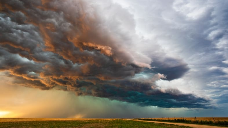
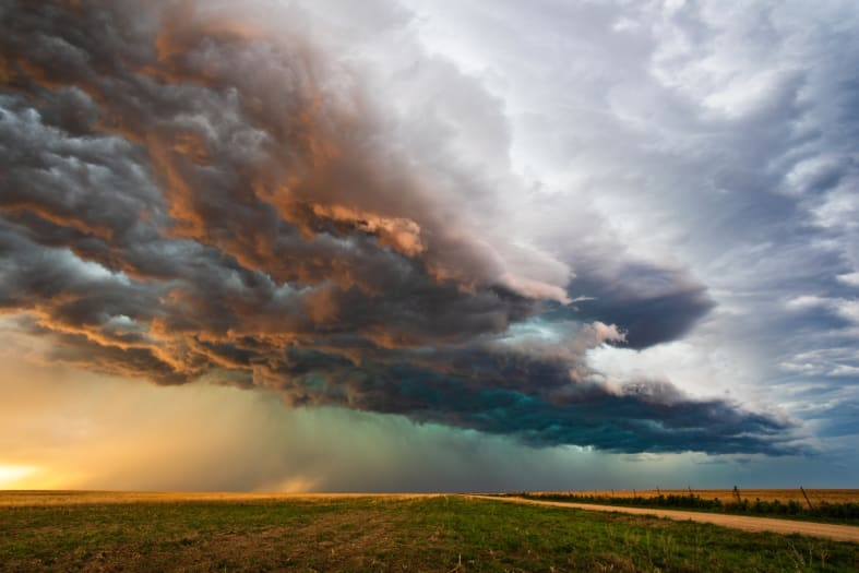
Fuerte tormenta para Thanksgiving: Las nevadas de casi dos metros de altura en el oeste del estado de Nueva York han llevado a las autoridades locales el sábado a restringir aún más los viajes por carretera y obligaron a las aerolíneas a cancelar vuelos en el área de Buffalo, justo antes de la ajetreada semana de vacaciones de Acción de Gracias.
Se han registrado nevadas de más de 6 pies (1,8 metros) en dos lugares, según el Servicio Meteorológico Nacional. En Orchard Park, donde juegan los Buffalo Bills de la NFL, la nieve fue de 77,0 pulgadas (1,95 metros) en las últimas 48 horas, y Natural Bridge, justo al este de Watertown, fue de 72,3 pulgadas (1,8 metros), cifras históricas para el área.
Casi 55 millones de estadounidenses viajarán más de 50 millas esta semana mientras EE. UU. se prepara para celebrar el Día de Acción de Gracias, y el Centro de Pronósticos FOX está rastreando una posible tormenta en el este que podría afectar los planes de vacaciones y los viajes para el fin de semana posterior al Día de Acción de Gracias.
El miércoles se perfila como un día ajetreado para viajar, con millones de estadounidenses saliendo a la carretera, tomando un vuelo o abordando un tren para llegar a sus destinos antes del Día de Acción de Gracias. Pero advierten que tengan cuidado con el clima.
¡SE REGISTRAN MUERTES!
Un conductor de quitanieves en la ciudad de Hamlet, Indiana, murió el viernes cuando su quitanieves se deslizó del pavimento y volcó, según el Departamento del Sheriff del condado de Starke. Hamlet está a unas 30 millas (48 kilómetros) del lago Michigan.
Los viajes de vacaciones son lo más importante para muchos antes de la semana de Acción de Gracias. Lastimosamente, muchas personas tuvieron que posponer estas salidas para quedarse en casa por la fuerte nevada que azotó a una parte del país.
“La lluvia no es un gran problema, pero cuando comienza a convertirse en nieve y visibilidad y visibilidad muy baja, tiende a ralentizar las cosas, si no a detener los viajes aéreos”, dijo el piloto y meteorólogo de Fox Weather “JP”. Las aerolíneas pueden lidiar con la lluvia, pero la nieve comienza a paralizar las operaciones del aeropuerto.
El pronóstico del tiempo para el Día de Acción de Gracias verá temperaturas más frescas en la mitad este del país, y existe la posibilidad de lluvia desde la costa del Golfo hacia el sureste y el Atlántico medio, así como en los Grandes Lagos, los valles de Ohio y Tennessee y partes del noreste.
Los vientos también serán ligeros en la Gran Manzana, lo que hará que sea mucho más fácil para los enormes globos volar por las calles de la ciudad por la mañana. Atlanta probablemente verá otro día de temperaturas a mediados de los 60 en el Día de Acción de Gracias, y existe la posibilidad de ver algo de lluvia durante el día. Con información de Fox Weather y CNN.
Por Fátima Martínez

Thanksgiving week weather for NJ: Cold and dry now, warmup ahead
The Bottom Line
The headline of this article tells it all: We begin the week firmly embedded in a cold and very dry air mass. But improvements are on the way, as thermometers rise to seasonable levels by midweek. Perfect timing for the Thanksgiving holiday.
Other than the chill, there will be no issues for the pre-Thanksgiving travel rush. But there are a pair of storm systems that could dampen the holiday weekend — one on Friday, and another on Sunday. Both look wet (if that), not wintry.
Monday
For the first time this season, every corner of New Jersey has frozen on this Monday morning. As of this writing (5:45 a.m.), temperatures range from 12 degrees in northwestern New Jersey to 30 degrees to the southeast. Brrr!
Monday will be better than Sunday — not as windy and slightly warmer. But it’s still going to be breezy and pretty chilly. Look for sunny skies and very dry air. (The dew point will be the single digits — chapped lips and parched throats galore.) The west-southwest wind may occasionally gust to 2 mph. High temperatures are forecast to reach the lower 40s. Still 10+ degrees below normal for mid-late November. But again, better.
A few clouds may creep in Monday night. And I could see a flurry or two flying around the northern part of the state. A freeze is likely for most of the state, with lows in the upper 20s to around 30 degrees.
Tuesday
More improvements. It will be sunny and slightly warmer. High temperatures in the upper 40s. Maybe 50 in far South Jersey. Still 5+ degrees below seasonal norms. But at least winds will be considerably lighter.
Wednesday
After a 9-day cold snap, we will finally see a return to seasonable temperatures on Wednesday. (Normal highs for late November are in the lower 50s, by the way.) 50 to 55 degrees Wednesday afternoon, with lots of sunshine. Should be a pleasant November day. (Note: I didn’t say “warm” necessarily.)
Dry weather and calm winds will mean no weather issues on the roads, on the rails, or in the air. Great news for one of the busiest travel days of the year.
Thanksgiving Thursday
Clearly, the most important part of the Thanksgiving forecast is the morning, with the Macy’s Thanksgiving Day Parade in New York and the 6abc Dunkin’ Thanksgiving Day Parade in Philadelphia. I’m happy to say it looks like a great day for a parade: temperatures in the 30s, dry weather, and light winds no more than about 10 mph.
The rest of your Thanksgiving holiday looks equally delightful. Clouds will increase, putting an end to this long stretch of sunny days. But our weather and air will stay completely dry. A little wind shift will probably keep temperatures a degree or two cooler than Wednesday. But lower 50s is right about where we should be this time of year.
The Extended Forecast
There will be some hiccups and speed bumps in the weather department through the rest of the holiday weekend.
Models have been fairly consistent in showing a storm system driving rain through New Jersey on Black Friday. While the latest GFS model backs off the wet weather a lot (still keeping showers to the north and east), the Euro model is full steam ahead on a period of wet weather. So we shall see how heavy and widespread the rain will be. A dry day is a possibility for Friday too.
One thing I’m fairly confident about: No snow or ice Friday.
While Saturday’s weather should be good, another potential storm system is looming for Sunday. Another very busy travel day.
I don’t want to go too heavy on details yet, since it’s still seven days away. Just know that another area of low pressure tracking directly over New Jersey could lead to another period of wet weather. I’m not seeing any intrusion of colder air, leading to wintry weather issues. But I wouldn’t rule it out for this one.
BY Dan Zarrow
Debe estar conectado para enviar un comentario.